Speldetails
 Dit is de originele tekst in Engels.
Terug naar de Nederlands vertaling.
Dit is de originele tekst in Engels.
Terug naar de Nederlands vertaling.
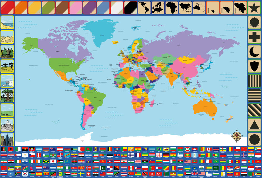
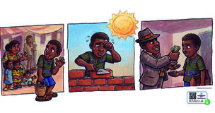
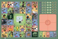
During the game, all players have on other player guess a country by just describing the country and/or country flag using the icons on the boarder of the game board.
The player who is going to guess, steps away so he doesn't know which country the group chooses.
Once the country is chosen, the player who is going to guess returns to the group.
Than the players take turns placing a bottle cap on an icon on the board to try to help the player who is going to guess the country. They can, of course, help each other choose the icons that best characterise the country or the flag of the country.
The player may guess as many times as he wants. However, the other players can only answer with yes or no to these guesses.
If the player has guessed the country correctly, they earn a point.
If the player cannot guess the country and gives up, the other players reveal the animal.
Now, another player can guess a country.
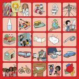
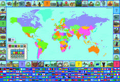
On the border of the poster, you can find different characteristics that can be linked to the countries. Each characteristic has a coloured border. The characteristics with the same-coloured border, belong to the same category. The icons are depicting (starting from bottom left clockwise):
Als je dit spel hebt gespeeld, help dan andere mensen te informeren door een beoordeling te geven.
Aarzel niet om je feedback te delen en help anderen om de juiste spelletjes te kiezen. Vertel ons hoe het was en hoe de kinderen reageerden? Of heb je advies voor andere spelers, een leuke variatie, een mogelijke verbetering?
![]()
Wij waarderen het zeer dat jij de moeite neemt om een recensie te schrijven.

Speldetails

Speldetails

Speldetails
Opgeslagen cookies